
GFS, IFS, ICON and NBM are all pointing at the same thing. Something wet is coming for Arizona early next week. Exactly when, and how much, keeps moving around from run to run.
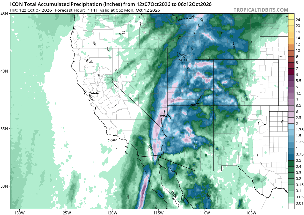
Part of that wobble might be coming from somewhere else. There’s a real hurricane threat taking shape in the Gulf of America/Mexico. It’s named Tropical Storm Isaias. It’s forecast to become a hurricane before it reaches the Gulf Coast States on Friday. Isaias itself is tracking well east of here. But a system that big reshapes the weather around it. That is probably part of why the timing on our system keeps moving. Worth watching alongside the model runs themselves.
I want to be careful here. Earlier today I was ready to write that Flagstaff gets wet Sunday and Anthem lags into Tuesday, based on the GFS heatmap atlas. Then I pulled the full 10-day outlook for both locations, and the picture got murkier. Anthem’s Sunday numbers are actually a bit higher than Flagstaff’s across most of the models. Both locations look wet. The exact day is what’s still moving.
Here are the 10-day outlook for Flagstaff and the 10-day outlook for Anthem. Flagstaff’s chance of rain climbs from 43 percent Sunday to 77 percent Monday. Anthem actually leads Sunday at 53 percent, and stays in the 70s through Tuesday. Both locations are looking at a wet stretch, Sunday into Wednesday. It’s just not lining up day for day between the two.
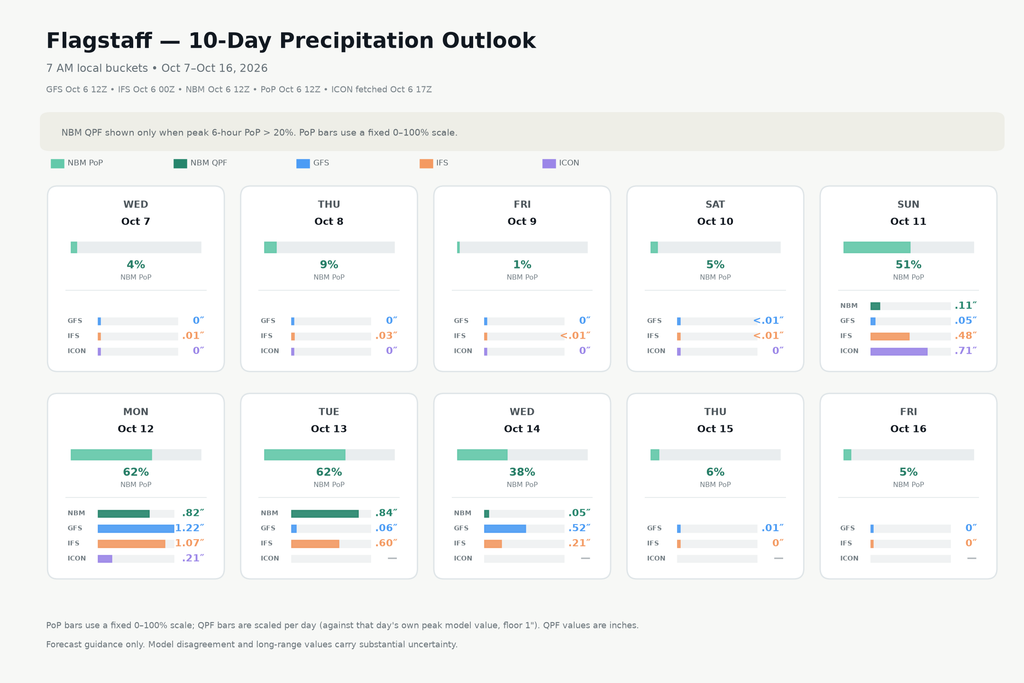
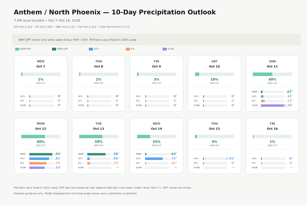
Five-plus days out, with a tropical disturbance still deciding what it wants to do, this has real room to shift. We need to keep watching the Gulf and the model runs and update before the weekend. For now: a wet stretch is coming for both Flagstaff and Anthem, sometime Sunday through Wednesday.