
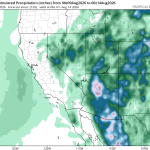
The Southwest turns wetter this week, and Thursday, August 13, is emerging as the day to watch.
The large-scale ICON, ECMWF, and GFS forecasts all show substantial precipitation across Arizona and the Southwest through early Friday. They disagree on the exact placement and totals, but the broader message is consistent: the pattern supports a meaningful increase in rainfall.
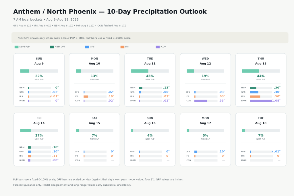
For Anthem / North Phoenix, Thursday stands out clearly. The NBM probability of precipitation is 44%, while the precipitation forecasts are 0.30″ from NBM, 0.40″ from GFS, 0.50″ from IFS/ECMWF, and 1.08″ from ICON. ICON is much wetter than the others, but all four models are producing measurable—and potentially significant—rainfall.
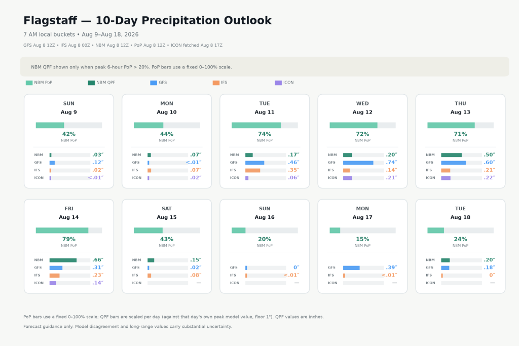
Flagstaff also looks wet Thursday, with a 71% NBM precipitation probability and model totals ranging from about 0.2″ to 0.6″. But unlike Anthem, Flagstaff appears to be part of a broader multi-day wet period extending from Tuesday through Friday.
The site’s forecast heatmaps add another useful piece of evidence. Thursday has been showing up repeatedly in prior model runs rather than suddenly appearing in one forecast cycle. That run-to-run persistence increases confidence that the signal is real, even though the exact amount of rainfall remains uncertain.
So we now have three things pointing in the same direction: the regional precipitation maps, the local outlooks, and the forecast-history heatmaps.
Bottom line: Thursday is looking increasingly interesting across Arizona, and particularly for Anthem/North Phoenix. The question is shifting from whether there is a rain signal to how widespread and how heavy the rainfall becomes.