
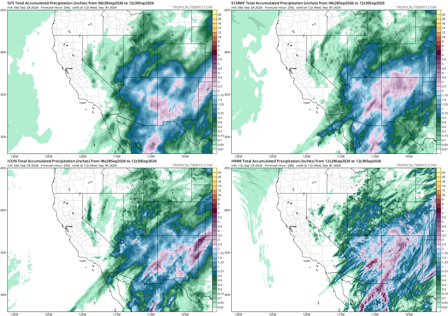
As rain falls over most of Arizona, The picture for Wednesday just got a lot more consistent. GFS, ECMWF, and ICON, all off this morning’s 06z run and valid at the same hour, Wednesday at noon, now agree on a wide band of moderate to heavy rain covering essentially all of Arizona and New Mexico, not just central Arizona. Not a small shift. A few days ago this was still a split call, wet in one model, dry in another.
HRRR backs it up, valid at that same hour. Higher resolution means finer, streakier detail on the map, but the story underneath is the same: heavy totals over central Arizona and the higher terrain, not an isolated pocket.
I’m not pulling exact numbers off these maps, that’s not what they’re for. What matters here is agreement. Three global models plus the short-range HRRR all landing on the same broad, heavy signal is worth more than any one of them alone.
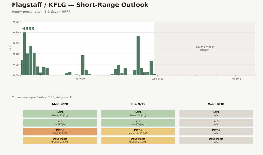
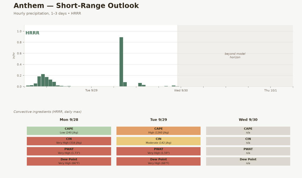
One more thing. The site’s own short-range outlook just lit up for Anthem. CAPE jumps to High, 1260 J/kg, on Tuesday, with PWAT and dew points both Very High. That’s not just rain, that’s fuel for thunderstorms. Flagstaff doesn’t show it, CAPE stays Low there both days. This looks like an Anthem problem, not a statewide one.
One hour on Tuesday puts almost 0.9 inches on Anthem. In a single hour. That’s a downpour, not a soaking rain.
Everyone’s wet now. Anthem might get hit hardest.