
One of the reasons for building this site was to track computer model forecasts in Arizona locations with strong terrain impacts on their weather. This site tracks computer model forecasts and precipitation reports for 3 CoCoRaHS locations in Anthem, and government sites in Flagstaff, Bellemont, and Munds Park. When a precipitation forecast such as the one for September 17, 2026, comes in unusually strong, it’s interesting to follow up and see what actually fell.
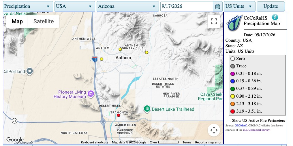
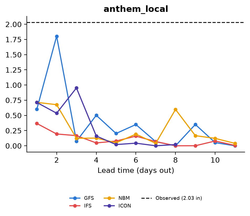
For my Anthem location, the GFS model suddenly predicted significant rain, but not until two days before. Even with the big prediction, the actual amount was higher, and the GFS model peak was the only model to come close. Another site to the south of this one reported over 3 inches. Still, it looks like the GFS model did the best job, albeit late in the timeline.
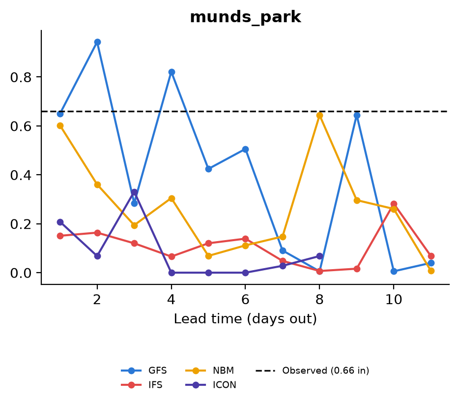
Until you look at what happened to Flagstaff, Bellemont, and Munds Park. First, Munds Park looks interesting, but not consistent. The NBM, which is a blend of other models, gets pretty close 8 days out and the day before. GFS looks repeatedly close. The European models, IFS and ICON, are consistently low. So, another win for GFS?
Flagstaff and Bellemont end up looking very similar, because they did not receive much rain.
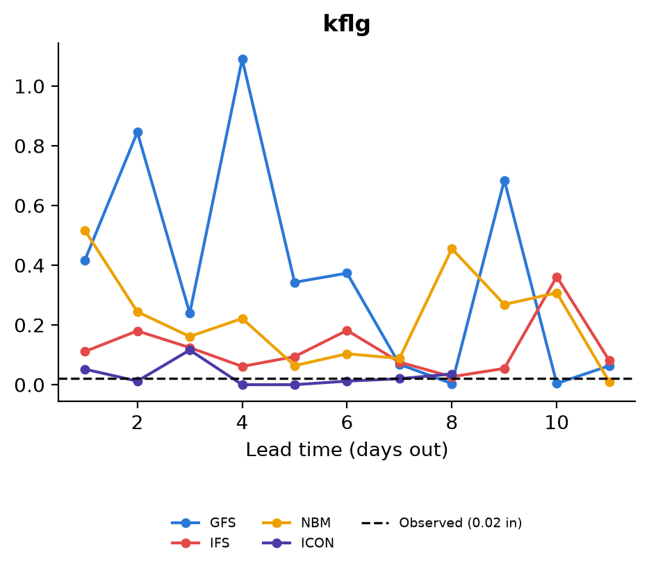
Wow, what a change. IFS and ICON are much closer and more consistently low. GFS is all over the place. And here’s the issue: long-range computer models aren’t very good at catching terrain effects.
The storms on September 17, 2026, had a mostly SSW to NNE flow to them. This favors heavy dumping in Anthem because of Daisy Mountain. Munds Park, which lies to the south of Flagstaff, was more in the target than either Flagstaff or Bellemont.