
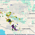
Hurricane Polo made landfall as a Category 2 near Las Barrancas, Baja California Sur on Tuesday, 110 mph winds, then crossed the Gulf of California into Sonora. Odalys had already come apart by then, but its leftover moisture tagged along with Polo’s, and the combined plume pushed north into Arizona. NWS Flagstaff had a Flood Watch out for the area, warning of heavy rain and possible impactful rises on area waterways, the Little Colorado River specifically. This wasn’t a marginal setup.
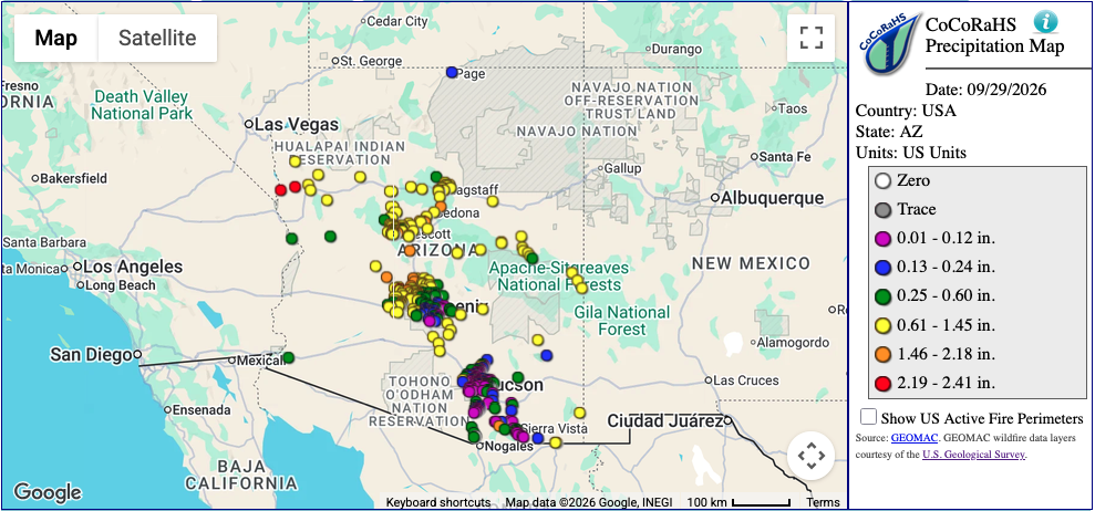
Here’s what actually fell at my Anthem gauges on September 29. 1.73 inches at Anthem 0.9 NE. 1.67 at the other Anthem station. 1.32 at Anthem 2.8 E. Tramonto picked up 1.65, Munds Park 1.60, Flagstaff’s airport gauge 1.00. Real station totals, not model output.
That gap at Anthem 2.8 E is worth a second look. It sits close to the other two Anthem gauges, but it came in noticeably drier, 1.32 inches against 1.73 and 1.67. My guess is terrain, specifically Daisy Mountain, the high point right in the middle of the Anthem community and the key feature for orographic lift at these sites. Polo and Odalys’s combined moisture moved through on a southwest-to-northeast track. The other two gauges may have been better positioned to catch lift off Daisy Mountain from that flow direction, while 2.8 E sat on the drier side of it. That’s a working theory. I haven’t verified it against the actual terrain data, but it would explain three gauges a short distance apart pulling three different totals out of the same storm.
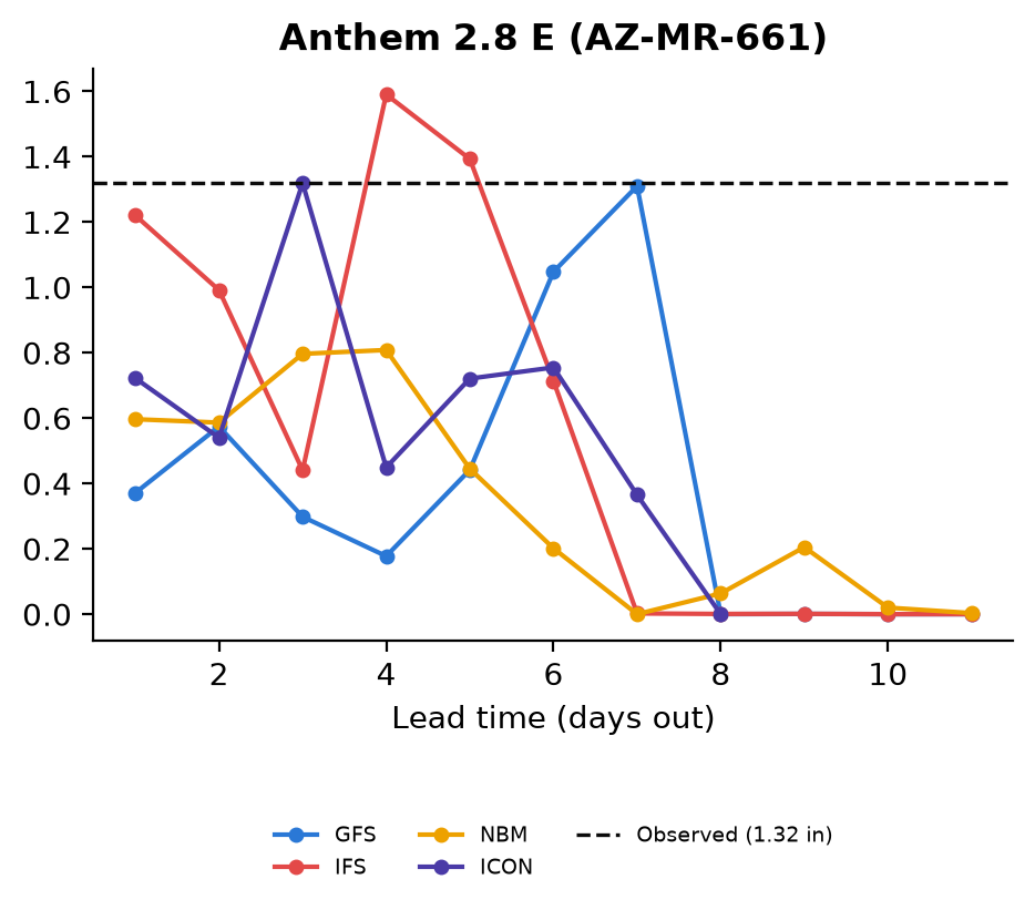
Now look at what the models were saying about Anthem 2.8 E in the days leading up to it. None of them held a steady read on it. GFS caught up to the eventual total about a week out, then dropped back the next day. IFS peaked well above it four days out, then pulled back too. ICON touched the total three days out and fell away just as fast. By the day before the rain, IFS was the closest of the four, and it was still a bit short. The other three were well under. If you’d only looked at the forecast the afternoon before the rain, you would not have expected 1.32 inches.
Flagstaff told a messier story. The observed total there was an even 1.00 inch. The models spent the better part of two weeks swinging past it in both directions, instead of settling down as the event got closer. GFS peaked at more than double the actual total, seven days out, then crashed back to almost nothing a couple of days later. IFS and ICON both jumped well above the final number around the same four-day mark that IFS spiked at for Anthem. That’s a forecast that never settled on an answer.
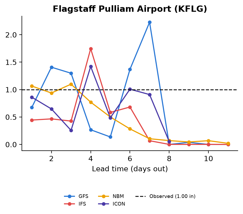
And the day before the rain? Still no agreement. The four models ranged from well under half the actual total up to just slightly over it. One came close. The other three didn’t, and there was no way to know in advance which one to trust.
So, another week, another version of the same problem. The models aren’t missing the Southwest completely, they clearly see something coming most weeks. What they can’t do is agree on how much, or settle into that agreement as the event gets closer, the way a short-range forecast should. We saw this with terrain back in the first post on this site. We saw it with Polo’s own track guidance a week ago. Now it’s showing up in the rainfall totals themselves, at two different mountain stations, from the same storm. Whatever it is about this part of the country, mountains mixed with monsoon moisture and now tropical remnants on top of that, it keeps beating the global models. Different storm, same lesson.