-
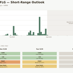
Every model just lined up on this one
As rain falls over most of Arizona, The picture for Wednesday just got a lot more consistent. GFS, ECMWF, and ICON, all off this morning’s 06z run and valid at the same hour, Wednesday at noon, now agree on a wide band of moderate to heavy rain covering essentially all of Arizona and New Mexico,…
-
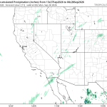
That wasn’t rain, that was virga
I saw light rain moving across central Arizona this morning and figured the models must have missed the timing on Polo’s moisture. So I went back through every run I had, ICON, ECMWF, GFS, and the high-resolution HRRR. None of them show meaningful accumulation over the area until later today. So which is wrong, what…
-
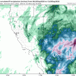
We are definitely in the splash zone!
Quick update on Polo. This morning’s runs came in noticeably wetter and more widespread than what we’ve been looking at. All three models, ICON, ECMWF, and GFS, are now painting a broad swath of rain across Arizona and New Mexico instead of the split picture we had a day ago, where ICON was the wet…
-
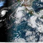
“Marco”…”Polo”
Hurricane Polo keeps changing the game on us. It hit Category 5 last week, eased back to a Category 4, and as of this morning’s advisory it is a Category 5 again. The remnant moisture headed for Arizona is tied to all of that, and the models still can’t agree on how much of it…
-
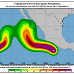
Hurricane Polo’s Remnant Moisture and Where the Models Disagree
Hurricane Polo blew up into a Category 5 storm off Mexico’s Pacific coast this week, and the remnant moisture from that system is the setup for Arizona heading into next Monday through Wednesday. Most of the national coverage on it is cautious, pointing at New Mexico as the bigger flood risk right now and saying…
-
Impact of Terrain on Arizona Weather Predictions
One of the reasons for building this site was to track computer model forecasts in Arizona locations with strong terrain impacts on their weather. This site tracks computer model forecasts and precipitation reports for 3 CoCoRaHS locations in Anthem, and government sites in Flagstaff, Bellemont, and Munds Park. When a precipitation forecast such as the…
-
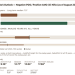
Forecasting Winter: Why You Should or Should Not Buy Your Snowbowl Pass Now
Quietly last week, my seasonal outlook tool updated itself. Nothing dramatic, no push notification, just a chart that shifted color. But if you’re eyeing an Arizona Snowbowl season pass, it’s worth a look before you swipe your card. Here’s the setup. This winter we’ve got a negative PDO, a positive AMO, and a weak El…
-

Computer models argue while mid-September and moisture abounds
Currently precipitable water amounts, the water hanging over our heads as water vapor, are running around 2 inches. Plenty of moisture is over Arizona. Still, several computer models are not agreeing on how much could fall in any of the locations I track. The GFS model is leading the way with Flagstaff precipitation nearing 1…
-
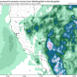
Thursday Is the Day to Watch
The Southwest turns wetter this week, and Thursday, August 13, is emerging as the day to watch. The large-scale ICON, ECMWF, and GFS forecasts all show substantial precipitation across Arizona and the Southwest through early Friday. They disagree on the exact placement and totals, but the broader message is consistent: the pattern supports a meaningful…
-
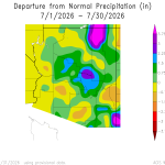
Was July 2026 wet or dry?
With El Niño being aggressively hyped, along with heavy rainfall predictions, it’s a good idea to look at what actually happened. And, possibly more importantly, what do we really know about our weather in Arizona. There it is. Wetter than normal in some places. Drier than normal in others. This data is based on weather…